
The Chalet in Grindelwald, at Alpiglen, Looking
Toward the Left Side of the Eiger. (Source: author)
It's true what was said in another "thin air" post: you have to escape sideways land and go to up-and-down land. And the Alps are a remedy supreme.
Yes, the Alps are a "squeezed" version of the mountains you find in Colorado, with both mountains and valleys between them pinched to extreme narrowness -- and none so obviously as Lauterbrunen valley in the Swiss Alps.
While dozens of miles lie between the bases of mountains in Colorado, Grindelwald, Switzerland, on the other hand, presents a panorama of very famous mountains very close at hand. Springing up from the land just across the road from your chalet are the Wetterhorn, the Mattenberg (itself the step up to the Kleine Schreckhorn and Schreckhorn), and the jagged peaks of the Finstraahorn and Flescherhorn just beside -- themselves just left of the Eiger. All of these rise up along the roadways round the village of Grindelwald.
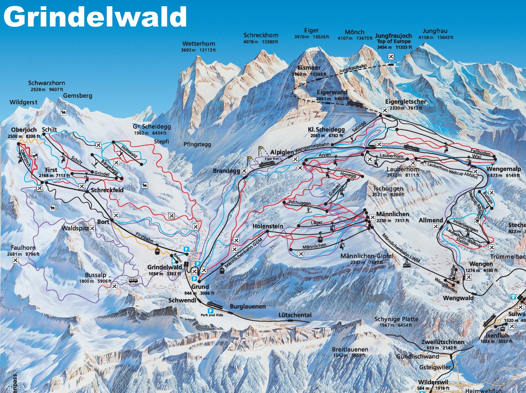
Grindelwald and Environs (click for larger map)
Nearness is what you notice. But more: the astounding angles they pose, rising steeply and unrelentingly from their bases. And that is true for all the Alps: French, Italian, and Austrian.
Perhaps the sharp, rising angles seen from valley to peak are even more extreme in Chamonix, France. There sits the ponderous and frosted Mont Blanc, of course, rising 15,700+ feet above the village and valley, looking so close from the balcony you might touch it (a deception, of course, yet so it looks). But along the ridges surrounding Chamonix are those needles of rock pricking the very sky as paragliders wander like butterflies above and around them all.
Indeed, even the narrow-gauge train from Martigny to Chamonix -- it's how you get there -- clings to a path just wide enough for it to creep along the edge. Along the climb up, you find points of solid rock on one side and a thousand feet of thin air on the other. Going around the outside turn gives you real pause -- is the train tipping off into the air? A little. But it clings to the track.

Train from Matigny to Chamonix (Source: ctfassets)
And as the train climbs, villages slide into view, perched upon the cliffs, houses stacked nearly atop one another on some narrow ledges, surrounded by more cliffs straight up and steep drops down. Little train platforms appear and, passing these, you note not 500 feet beyond that you can only see the tops of the buildings. Most village folk would be unable to look across to their neighbor's house and nod a "hello"; they can only see the rooftop immediately below their own house -- or the granite foundation of the house above.
What a village to live in! The quick jaunt to the store for bread would be a sweaty affair, climbing and descending those streets. How cars navigate them in winter...anyone's guess. Then you realize that the ride back down on the train requires very good brakes and find yourself asking hopefully, "Hmm. Do the French use the Swiss cog-train system?" (protecting the train from one very short and speedy careen to the first curve, tossing all the cars straight off the mountain).
But to wander (German word) -- to hike. Even a moderate climb on the trails to the many huts in these mountains brings you to some real, unguarded exposure, but also to what you're there for: the sense of "Wow! How did I get up here?!" as you take in the massive peaks and views that literally make you gape while you balance on rubbery legs. I'm too old now to use a rope and attempt vertical walls, but there were moments on this month-long trip -- moments where I considered, "Hmm. My rope wouldn't be amiss just here...." Photography in such moments fall in priority to footing.
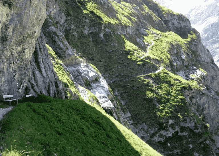
On the Way to the Baregg Hut (Source: Switzerlandlanding)
These huts, perched high on small outcroppings in the mountains of Switzerland are great delights in themselves. Hot chocolate (um...Swiss chocolate), sausages, sauerkraut, rostis, and...friendly staff if you use even a little German or French. Some of the huts are not only exposed but are set high up on the most precarious spots along a trail -- like the Glecksteinhütte above Grindelwald, at least a four hour one-way event with some dicey points. A jaunt to the Bäregg Hütte (Live Cam) is much shorter, albeit not without some exposure. Just so: one family on their way down with a young girl improvised a harness onto her with leash -- in case.

Heading to the Baregg for the View across to the Glacier (Source: author)
If you go up past the Hotel Wetterhorn, east of Grindelwald, you find not only a wonderful world of steep and lush woods (just where the first modern gondola on a cable system was built), but also trails at the base of granite walls towering so closely above that you have to lean back to look at them. At one point a sign indicates, "Frequent Rockfalls. Don't Loiter Here." The Upper Grindelwald Glacier (Oberer Grindelwaldgletcher) still exists, but only way up the mountain today. It can hardly be seen from the entrance to the glacier gorge, while in 1973 it was 4.1 miles long, and "only 20 years ago the glacier tongue reached the entrance of the gorge" (Our Heritage).
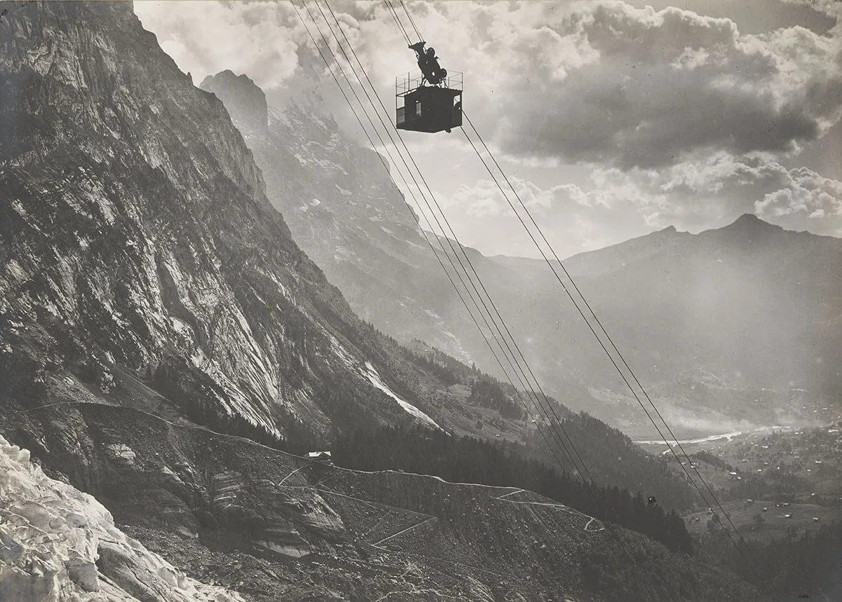
The First Gondola, Wetterhorn, 1908. (The Glacier
lower-left, the Oberer Grindelwaldgletcher,
has long since receded up the mountain today.)
And there's Chamonix, with, is it possible?, hikes even steeper in points. Not so steep is the Grand Balcon hike (mostly downhill in this direction): from the gondola station at Plan de l'Auguille to Montenvers and...well...what's left of the Mer de Glace glacier just below. This direction means going from high Alpine tundra down into deep woods.

Grand Balcon Hike, above Chamonix (Source: dumontbanc)
Along the way, huge masses of granite, fallen from the stone needles towering above, are covered with the same, bright green lichens you find in Colorado's mountains, but here -- way above the tiny, softly humming helicopters busy as bees in the valley below -- you meet the Chamoix (say "sham-wah"): cute, short-horned and somewhat shy mountain goats.

A Chamoix Peeps above Chamonix (Source: author)
At the end of this hike, you come out of the trees to find, set on the rock above the scoured valley where the thick glacier once crept along its icy way, the elegant stone Hotel du Montenverse with its restaurant and patio allowing a look across and down into the valley. Here's a very nice cool drink among the peaks and talk with visitors -- in this case from England.
But how to get down? The bright red, old-timey train, nearby -- another narrow gauge affair: in areas, the steepness most definitely requires a cog-wheel system. But even then, the cars, with their polished, wooden-slat seats straight out of the 1920s, hardly keep you from sliding off them and across the floor as the train angles down the mountain track.

Weedling its Way Down (Source: cremailler)
There's nothing like up and down land. Nothing. As I've said before, it's no good reading about it. You have to go there....
